FixerTravel
Travel guide maps
1
Banff
The town of Banff makes for a great jump off point to explore the eastern side of the park. When entering the park on the Trans-Canada Highway from the east, Banff is just after entering the park.
Fill up on groceries, grab some food at the many restaurants, or stock up on outdoor gear. There are a large number of outdoor outfitters to buy or rent gear.
2
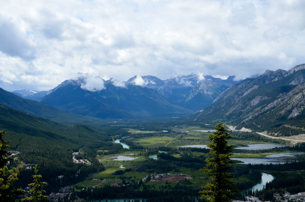
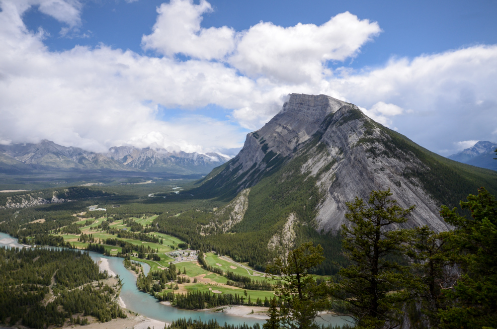
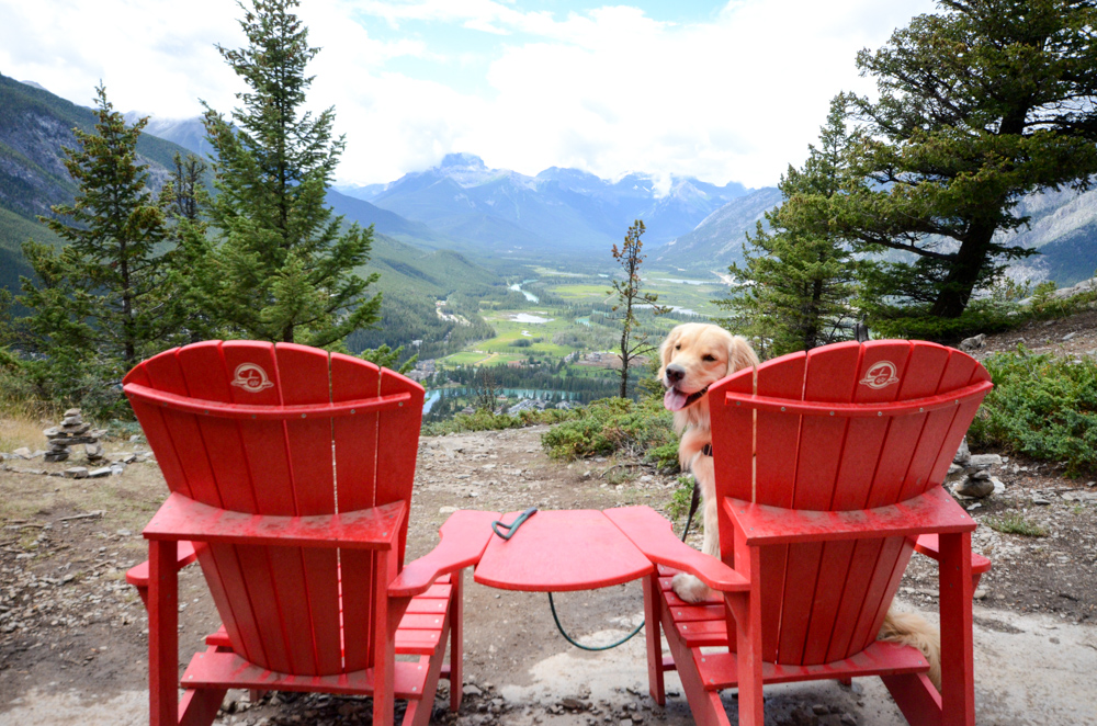
Tunnel Mountain
The small mountain in the town of Banff offers great views. There is a well packed and maintained trail with informative signs along the way, leading you to the top of the mountain.
Grab some snacks or a picnic lunch, park at the marker on the map, and head to the top for a great morning or afternoon spot.
4
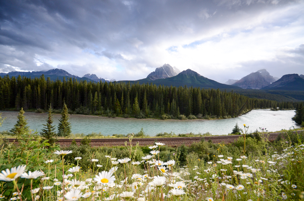
Bow Valley Parkway
West of the town of Banff, there is an option to take the scenic drive, or continue on the Trans-Canada Highway. When it is open, we recommend the scenic drive. Take the exit for the Bow Valley Parkway, for a rewarding drive through the heart of Banff National Park. There are plenty of turn outs, so be prepared to make many stops.
The parkway is only open during summer, as the road is not plowed.

5
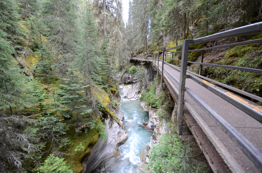
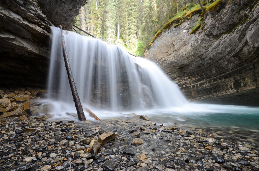
Johnston Canyon Trail
While driving along the Bow Valley Parkway, stop at the turn out for Johnston Canyon. There is an accessible trail that follows the river up the narrow canyon. You'll follow the river walking on catwalks, through the narrow limestone carved canyon. You will reach the lower falls after .6 miles (1.1 kilometers) of scenic trail. The lower falls are accessed via a bridge across the river to a tunnel through the canyon bedrock where you can get an up-close, and wet, view of the falls.
The upper falls are .9 miles after the lower falls (1.5 miles from the parking lot). Walk out onto the catwalk viewing platform to see the falls tumble 90 feet. Or climb the steep and short trail to the top of the falls.
Bring water and a snack, to sit at one of the many view points of the river and canyon. We recommend hiking shoes, as the trails can be wet and slippery.
The trail is open year round, though the trail is icy and cleats are often required during winter months.
6
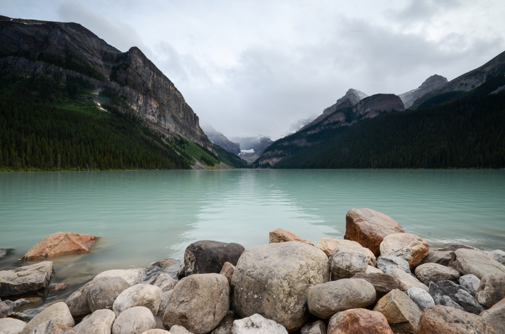
Lake Louise
Farther up the park is Lake Louise, which is another must-see. Beat the mid-day crowds and visit the lake for sunrise or sunset for great views, and a still, reflective lake. During the day, you can hike around the lake to the tea house on the Plain of Six Glaciers Trail. Be sure to ask rangers, as trails are sometimes closed completely or to small groups because of bear activity.
In the town of Lake Louise, there is a visitor center with extremely friendly rangers who can give you great advice on hikes in the area, as well as provide you with hiking maps.
7
Lake Louise Campground
The Lake Louise Campground is a great spot to stay for visiting Lake Louise and Moraine Lake. The tent campground can fill up quickly, so it is best to make reservations online as far in advance as you can.
When entering the campground, you'll notice a large, electric fence protecting you from the bears. Steer clear of the fence yourself, as you don't want to get shocked!
8
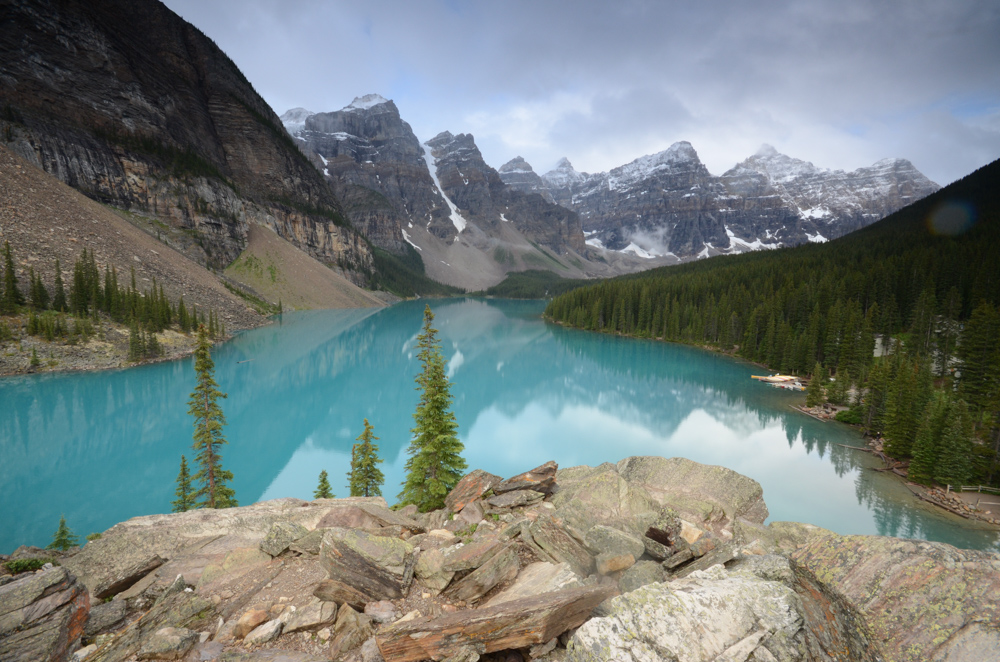
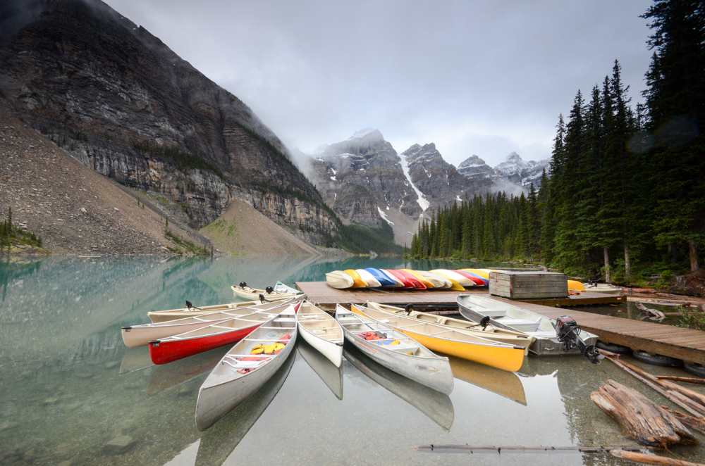
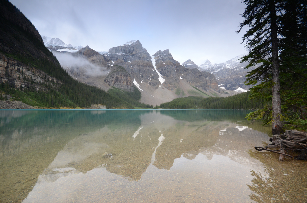
Moraine Lake
While less known than Lake Louise, Moraine Lake might actually be better. The road to the lake is closed during winter, but if it is open, this should be on your list of places to see. Moraine Lake is a beautiful turquoise color from the rock flour, and is a slightly different color than Lake Louise.
There are two hikes to do for the best photo spots. From the parking lot, head east, on the trail that crosses Moraine Creek, and follow it up to the rocky overlook for a picturesque panorama of the lake (see the first photo).
After, follow the trail around the west side of the lake, past the hotel and docks, catching views along the way of the peaks (see the third photo).
Travel like a pro: Set an alarm, and get up there for sunrise to beat the crowds. In addition, the lake will be a reflective mirror, before the canoes leave the dock, sending tiny ripples in every direction.
9
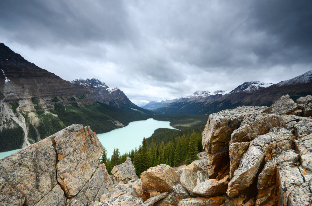
Bow Summit
Between Lake Lousie and Jasper National Park, the Icefield Parkway winds uphill until Bow Summit. You will pass by Bow Lake, which offers great reflective views of the mountains across the valley. The summit divides the park into north and south.
Park at the summit, and take a short hike to one of a few viewpoints for a rewarding view.
10
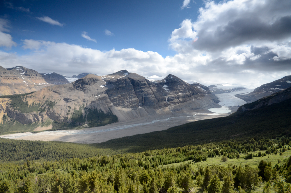
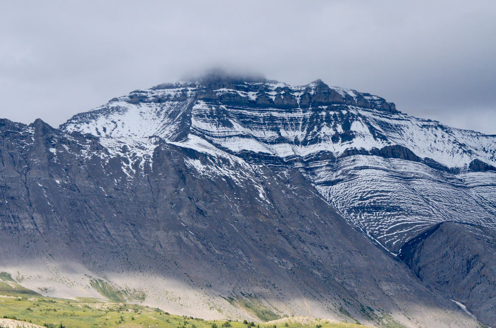
Parker Ridge
Parker Ridge is a must do day-hike in northern Banff National Park. The trail gains around 750 feet of elevation on well graded switchbacks, so take your time, and you'll be quite rewarded. At the ridge, you will get one of the few views of the Saskatchewan glacier in the park.
The Saskatchewan glacier is the longest of the glaciers feeding out from the Columbia Icefield, and feeds the North Saskatchewan River.
You will also get excellent views of Mount Athabasca, one of the tallest mountains around the Columbia Icefield, and in the Canadian Rockies.
Travel like a pro: Hike the trail in the morning or later afternoon to beat the heat, and avoid the crowds. Plus, the sun will be lower in the sky, creating better lighting for photos.
11
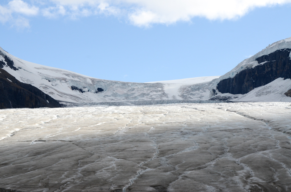
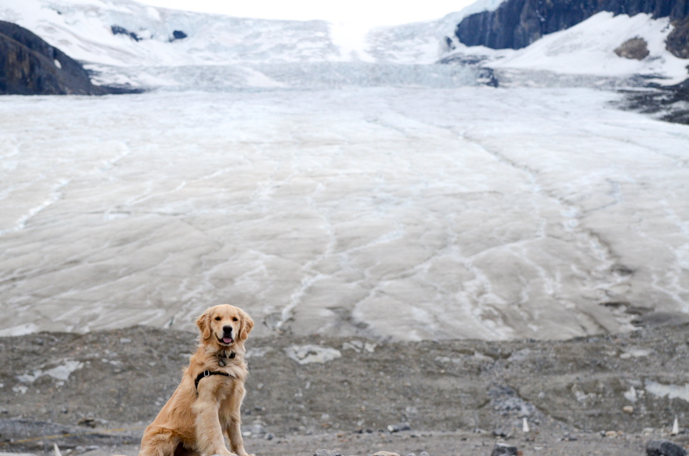
Columbia Icefield
The Columbia Icefield is the largest icefield south of the arctic circle. The icefield feeds eight major glaciers, and sits upon a triple continental divide, where rivers from the icefield flow into the Arctic Ocean, Hudson Bay, and the Pacific Ocean.
The Icefield Discovery Center offers tours of guided hikes out onto the Athabasca glacier, which is across the highway. You may need to reserve ahead of time, so call and check the day before you actually go. The Athabasca glacier is the most visited glacier on the North American continent.
If you don't do a tour onto the glacier, you can still get quite close. There is a parking lot with a short road leading to the front edge of the Athabasca glacier.
All of our map-based travel guides and itineraries are selectively curated by fellow travel enthusiasts.
Questions or suggestions? Let us know at contact@fixertravel.com. If you like the guides, please feel free to share with your friends!